Difference between revisions of "Rectifying maps"
Jump to navigation
Jump to search
(→Rectification, warping, georeferencing) |
|||
| (7 intermediate revisions by the same user not shown) | |||
| Line 1: | Line 1: | ||
| − | + | <gallery mode="slideshow"> | |
| + | File:Mapwarper.png | ||
| + | File:Mapwarper-warp.png | ||
| + | File:Mapwarper-pointlens.png | ||
| + | File:Mapwarper-points.png | ||
| + | File:Mapwarper-layer.png | ||
| + | File:Mapwarper-reveal.png | ||
| + | </gallery> | ||
| − | == | + | ==Rectification, warping, georeferencing== |
| − | Scanned maps can be projected onto today's maps to be able to use them as layers in different applications. This tool would make available a control point interface, which distorts the map image to match the base map. | + | [[Historical map|Scanned maps]] can be projected onto today's maps to be able to use them as layers in different applications. This tool would make available a control point interface, which distorts the map image to match the base map. |
Rectifying or georeferencing map files is accessed via the image actions menu or the Image viewer Actions menu. | Rectifying or georeferencing map files is accessed via the image actions menu or the Image viewer Actions menu. | ||
| Line 12: | Line 19: | ||
* Cross – to close the view and return to Image viewer or Images section | * Cross – to close the view and return to Image viewer or Images section | ||
* Search – to search for the location | * Search – to search for the location | ||
| + | * Settings – rectification settings | ||
* Basemap menu | * Basemap menu | ||
| Line 21: | Line 29: | ||
On the left side of the screen there is the menu of actions/views. | On the left side of the screen there is the menu of actions/views. | ||
| − | * | + | |
| − | + | ;The main views | |
| − | * Overlay (Overlay, transparency, lens, | + | * Linking with the Wikidata object |
| − | * | + | * Control point interface |
| + | * Overlay (Overlay, transparency, lens, swipe) | ||
| + | |||
| + | ; Further work | ||
| + | * Masking interface | ||
| + | * Tracing interface - and other interactions with OSM/OHM | ||
| + | * Export view | ||
| + | * Name picking view | ||
| + | |||
| + | ; Tool controls | ||
| + | * Undo / redo (control point interface) | ||
| + | * Lens (Overlay) | ||
| + | * Control point table (control point interface) | ||
| + | |||
| + | ; Settings (in the settings menu in the top bar?) | ||
| + | * Warping settings | ||
===Modals=== | ===Modals=== | ||
Latest revision as of 08:44, 6 December 2021
Contents
Rectification, warping, georeferencing
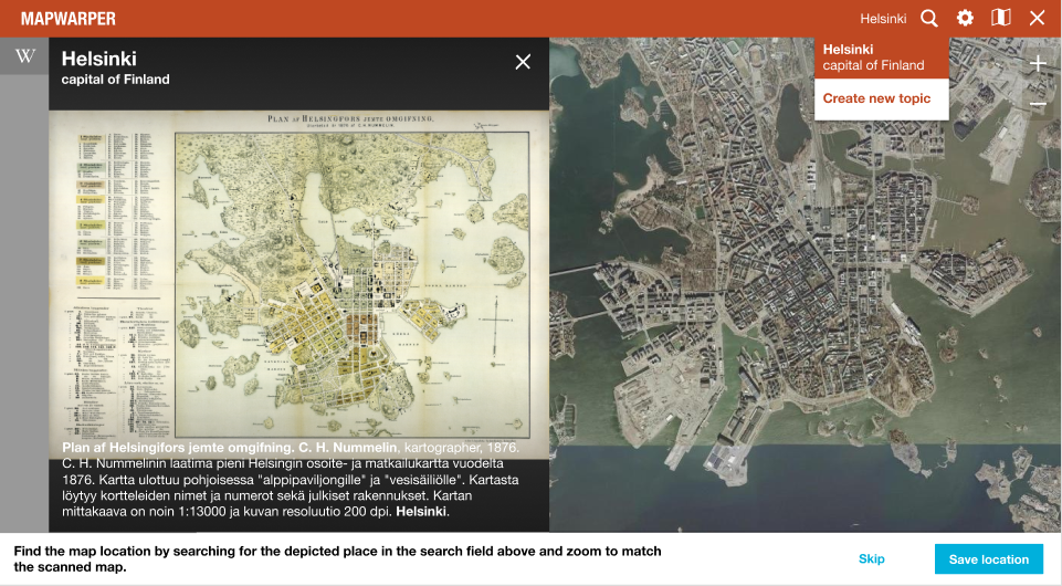
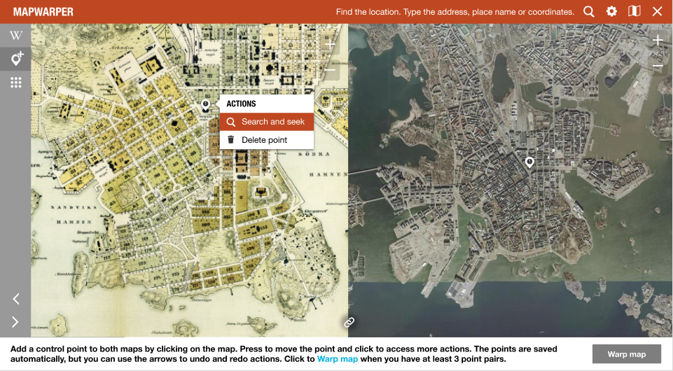
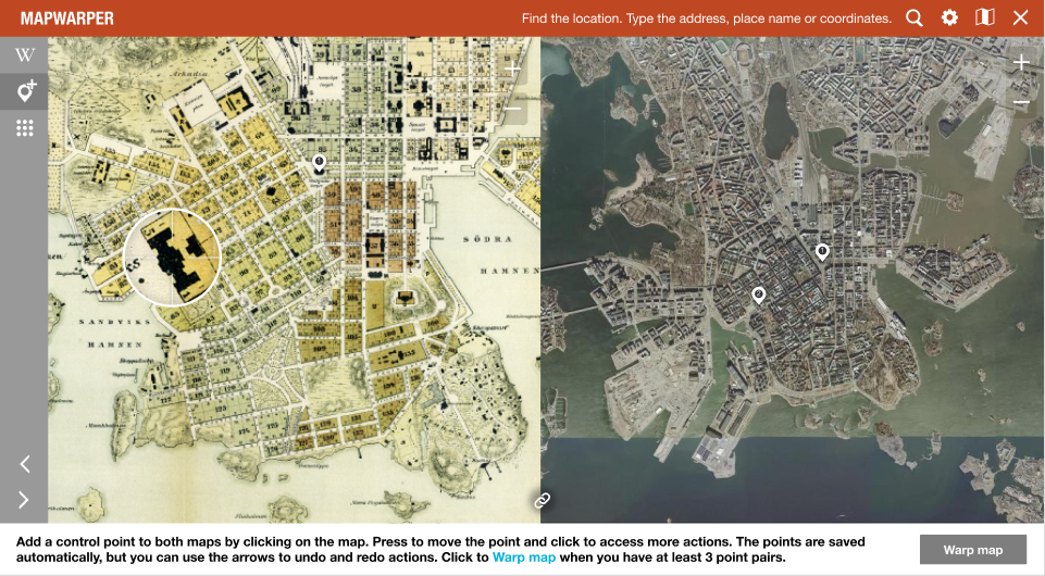
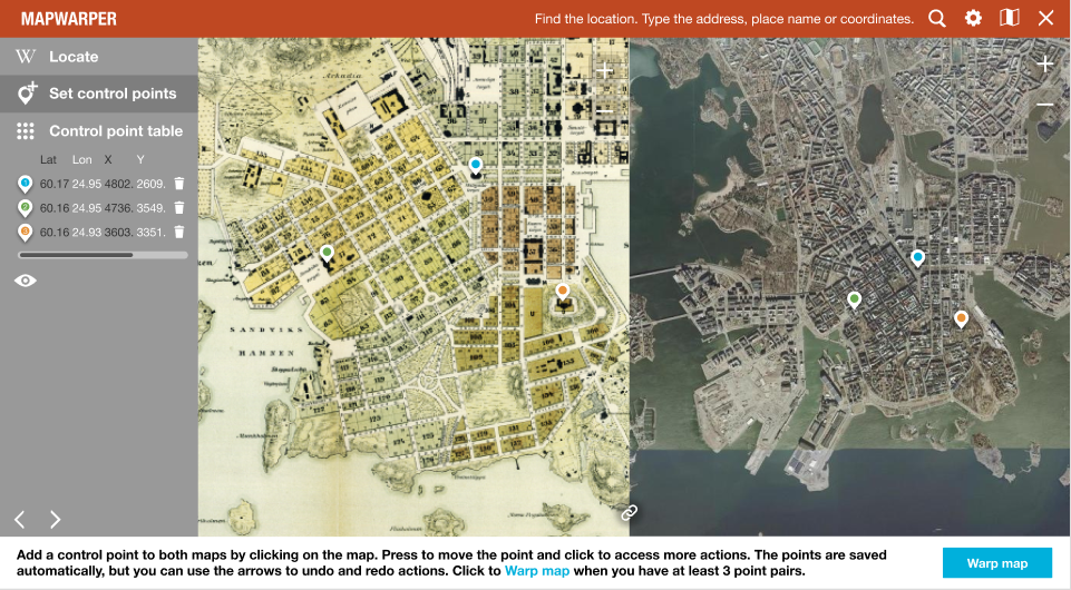
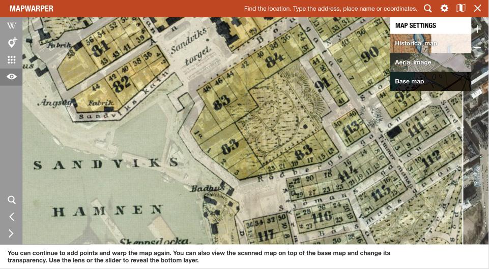
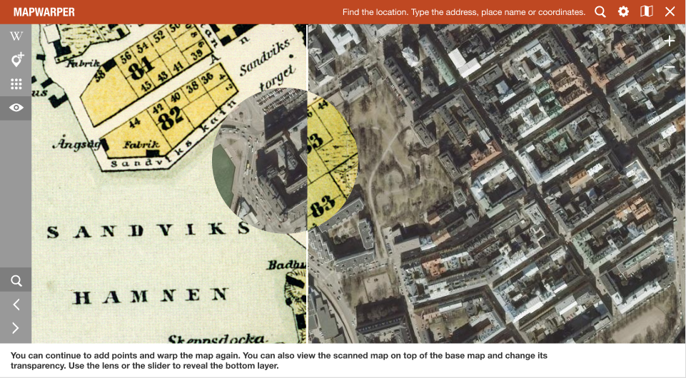
Scanned maps can be projected onto today's maps to be able to use them as layers in different applications. This tool would make available a control point interface, which distorts the map image to match the base map.
Rectifying or georeferencing map files is accessed via the image actions menu or the Image viewer Actions menu.
The layout of the tool is made uniform across tools.
General controls
- Cross – to close the view and return to Image viewer or Images section
- Search – to search for the location
- Settings – rectification settings
- Basemap menu
Instructions area
- Stepped instructions
On the left side of the screen there is the menu of actions/views.
- The main views
- Linking with the Wikidata object
- Control point interface
- Overlay (Overlay, transparency, lens, swipe)
- Further work
- Masking interface
- Tracing interface - and other interactions with OSM/OHM
- Export view
- Name picking view
- Tool controls
- Undo / redo (control point interface)
- Lens (Overlay)
- Control point table (control point interface)
- Settings (in the settings menu in the top bar?)
- Warping settings
Modals
- New item modal
Metadata
- Metadata can continuously be accessed below the rectification interface
| About | Technology | Design | Content modules | Tool pages | Projects |
| Status
Wikidocumentaries Slack |
Setting up dev environment |
Components |
Active modules Module ideas |
Visual editor | Central Park Archives |
