Difference between revisions of "Geolocating tool"
(→Step 2) |
(→Storing geotagging data) |
||
| Line 92: | Line 92: | ||
!Thing | !Thing | ||
!Wikidocs Wikibase property | !Wikidocs Wikibase property | ||
| − | !Wikidata SCD property | + | !Wikidata / SCD property |
|- | |- | ||
| − | | Image URL |||| | + | | Image URL |||| download link (P4945) |
|- | |- | ||
| Image info page |||| Missing | | Image info page |||| Missing | ||
Revision as of 08:29, 28 December 2018
In Wikidocumentaries all openly licensed images can be geotagged. This is not available for images, whose reuse is restricted.
There will be an internal desktop geolocating tool, and the images can also be rephotographed and geotagged with the Ajapaik mobile app.
Contents
Accessing the geolocating tool
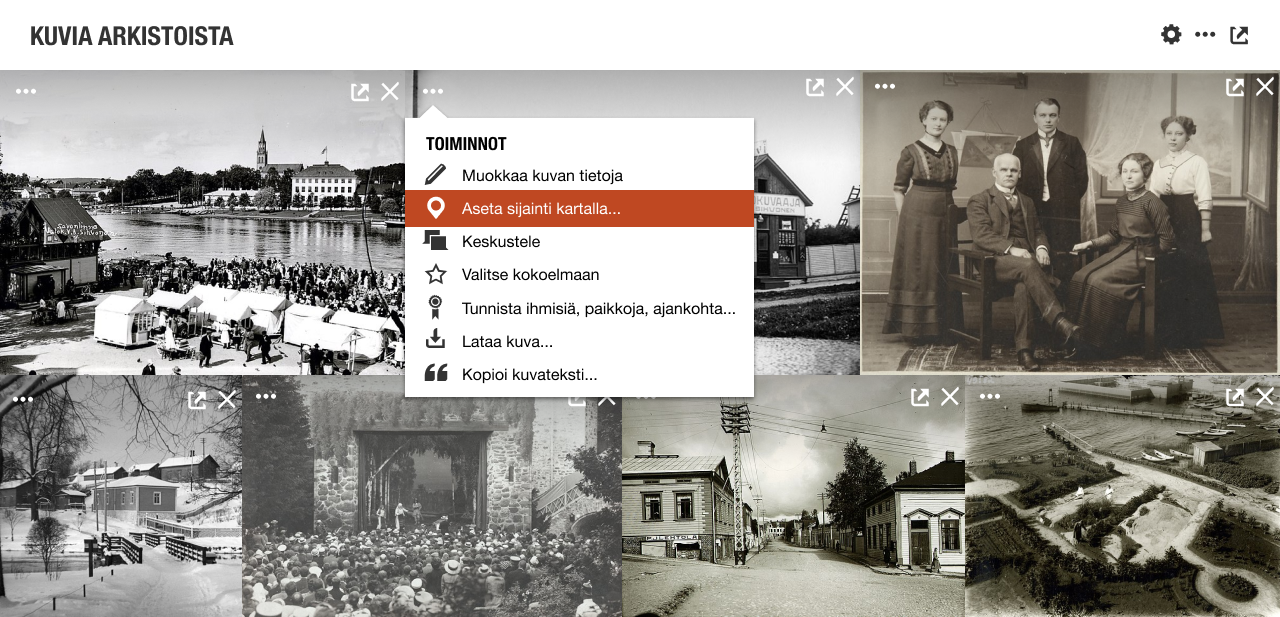
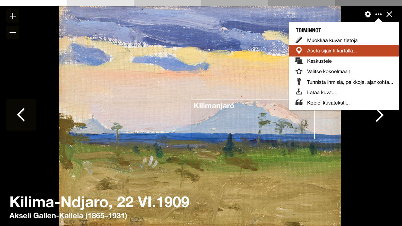
Access to geotagging is available with each image in the images module on the topic page and the image image viewer.
- The most essential metadata of an image is saved into Wikidocumentaries on the moment it is selected for enriching. Any action in the actions menu will make this happen.
Properties added to the image item
- imageURL
- imageHash
See Metadata mapping for more info.
The workflow
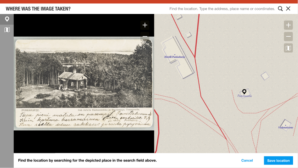
The geotagging interface is based on the Wikidocumentaries tools layout. It includes a split view of the zoomable image and the zoomable map.
Enhancement ideas:
- The map could seek to a suggested location by parsing the data in the name and description, or existing location information in the image metadata.
Step 1
Choose an existing location with the search pulldown (data from Wikidata and Wikidocumentaries).
- Prompt: "Find the location by searching for the depicted place in the search field above."
- Buttons: "Set location" and "Reset".
- Action "Set location"
- A BLACK pin is placed on the map showing the location of the target item. > Step 2
- The target item is saved with the image metadata (in property "depicts"). Because the image can depict several items, it may be useful to either have a special property for the target or a qualifier for the target item in the "depicts" property.
- What does "Reset" do? Return to initial state.
If the item does not have coordinates, the user is asked to add the location of the target (moving the POI to the right location).
- A RED pin is placed on the map showing the location. > Step 2
If the item does not exist, the user (can add the item and/or) is asked to just add the location of the target, like above.
- A RED pin is placed on the map showing the location. > Step 2 (with possible intermediate step see below.)
Enhancement ideas:
- Add topic if it does not exist?
Step 2
The user can modify the location of the pin.
- The pin turns to RED if modified.
The location is confirmed
- Prompt: "Modify and save the location. You will be recorded as the source of the new location."
- Buttons: "Save location" and "Cancel".
- Action "Save location"
- The pin turns GREY. > Step 3
- The coordinates are saved with the target item.
- What does "Cancel" do? Remove the pin > bad idea. Return to previous screen > Bad idea. Return to the first question of selecting the target > Better idea.
Enhancement ideas
- Add topic if it does not exist? > Add topic modal
- Display existing topics around the selected location? > Allow changing the main location from a pin pulldown.
Properties added to the image item
- Selected target QID: equivalent of depicts (P180)
- Selected target coordinates:
Step 3
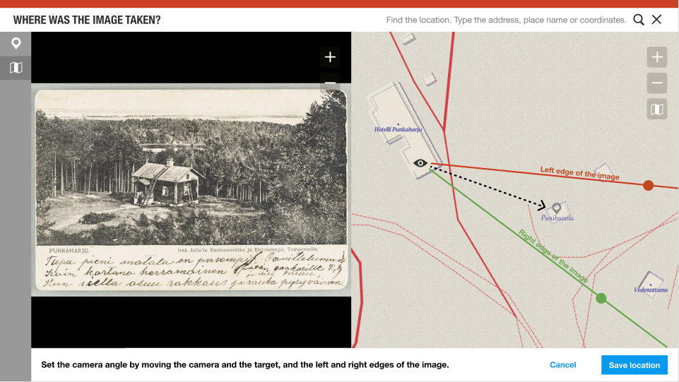
- The user will place the camera, the target and the camera angle on the map.
- The user can skip this and save only the point.
Controls
- It should be possible to use different background imagery: Aerial images, OSM, local official open map sources, historical maps. Maybe even display nearby images? This interface should be similar to the map interface in the topic page.
- Address or geographic search may be used to help find the location.
Enhancement ideas
More detailed definition
- Adjust left and right edges of the image on the image
- The user could select items displayed on the map and equivalent items in the image. The field of view could be adjusted automatically based on that. (There will be an illustration of this). ** Verify if POIs that are in the field of view can also be seen on the image. Drag the POIS on the image to right locations
3D-view. Elaborating the idea by Matthias Müller-Prove. See screenshot in the end of the page.
- After setting the camera position and the target on the map, the user could fine tune the values in perspective mode:
- Image and map overlaid
- Change the elevation of the image target and the photographer position. Calculate pitch.
- The user could frame the side of a building (or other object: street, pond, statue...) in the image and locate the equivalent on the map. This could give an estimation of the photographer's position.
Storing geotagging data
The geotagging data is added to the local image metadata. Possible properties include:
| Thing | Wikidocs Wikibase property | Wikidata / SCD property |
|---|---|---|
| Image URL | download link (P4945) | |
| Image info page | Missing | |
| Image hash | Missing | |
| Camera location | coordinates of the point of view (P1259) | |
| Main target ID | depicts (180) but more to know that this is the main target. | |
| Main target coordinates as a fallback. Target coordinates saved onto the target itself | coordinate location (P625) on the target item | |
| Camera azimuth, compass direction, camera heading, yaw. Compass degrees. | Missing? | |
| Field of view (degrees) | field of view (P4036) | |
| Lens focal length | Should it be combined with field of view, think how | focal length (P2151) meters and millimeters |
| Other target IDs in the image | How to store location in image? As annotations? Is the resulting azimuth enough? | depicts (P180) + relative position within image (P2677)? |
| Tilt, pitch, comparison of camera and photographer elevation to distance. Degrees. | Missing? | |
| Camera used | image captured with (P4082) |
We can also contribute to a standardised exchange format for geotagged photos.
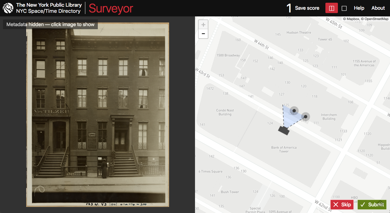
- RESEARCH methods for verifying crowdsourced contributions (eg. Ajapaik & Surveyor)
Importing to Wikimedia Commons
- The original image, the image metadata and the added geolocation will be imported to Wikimedia Commons either manually immediately or as a scheduled bot task later. ENSURE equivalent properties in SDC.
- The original memory institution will be able to read the enhanced data from Wikimedia Commons. INVESTIGATE best practises.
Inspiration
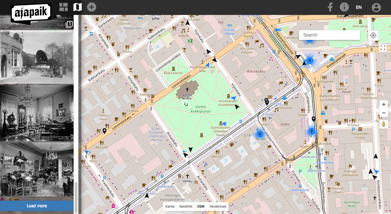
Ajapaik web app
| About | Technology | Design | Content modules | Tool pages | Projects |
| Status
Wikidocumentaries Slack |
Setting up dev environment |
Components |
Active modules Module ideas |
Visual editor | Central Park Archives |
