Difference between revisions of "Geolocating tool"
Jump to navigation
Jump to search
Susanna Ånäs (talk | contribs) (→2. Access to geotagging is available with each image in the images module and the image viewer.) |
Susanna Ånäs (talk | contribs) (→Step 1) |
||
| Line 42: | Line 42: | ||
''Enhancement ideas:'' | ''Enhancement ideas:'' | ||
* The map could seek to a suggested location by parsing the data in the name and description, or existing location information. | * The map could seek to a suggested location by parsing the data in the name and description, or existing location information. | ||
| + | {| class="wikitable" | ||
| + | |+ | ||
| + | !Wikidocs Vue variables | ||
| + | !Wikidocs Wikibase property | ||
| + | |- | ||
| + | | || depicts (P180) | ||
| + | |} | ||
====Step 2==== | ====Step 2==== | ||
Revision as of 21:20, 6 December 2018
In Wikidocumentaries all openly licensed images can be geotagged. This is not available for images, whose reuse is restricted.
There will be an internal geotagging app, and the images can be rephotographed and geotagged with the Ajapaik mobile app.
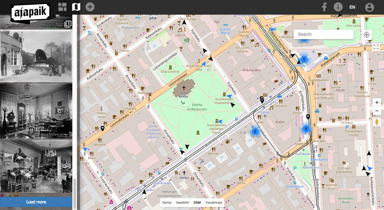
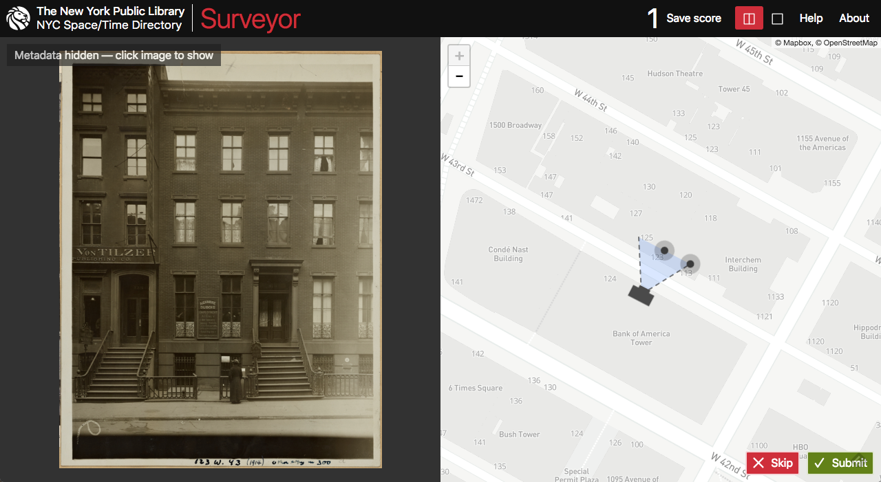
The tool is inspired by the work done in the Ajapaik.ee project of the Estonian Photographic Heritage Society and based on the Surveyor project for New York Public Library Labs.
Workflow for geotagging
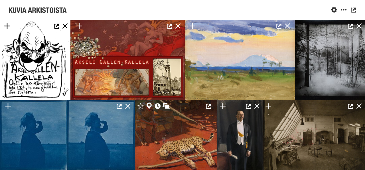
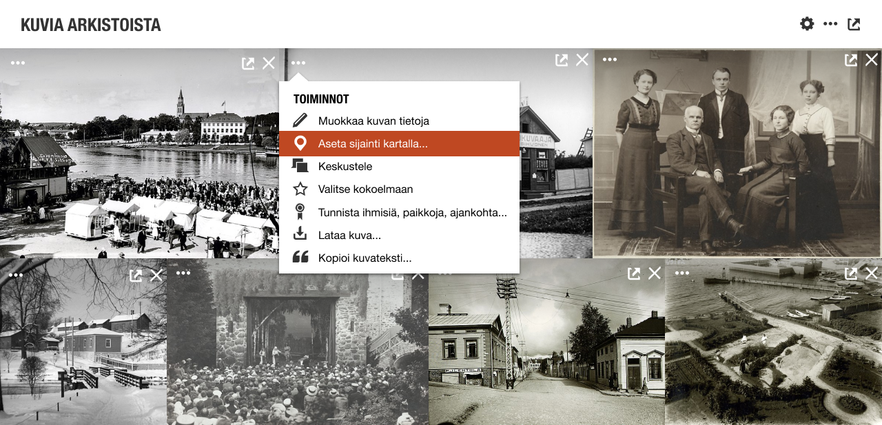
1. Images are viewed in the topic page's images module or an image viewer.
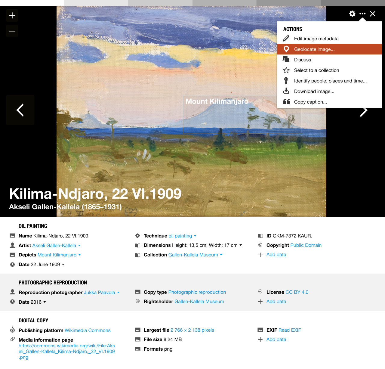
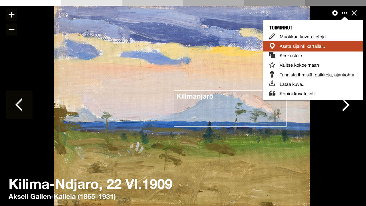
2. Access to geotagging is available with each image in the images module and the image viewer.
- The most essential metadata of an image is saved into Wikidocumentaries on the moment it is selected for enriching. Any action in the actions menu will make this happen.
| Wikidocs Vue variables | Wikidocs Wikibase property |
|---|---|
| imageURL | |
| imageHash |
See Metadata mapping for more info.
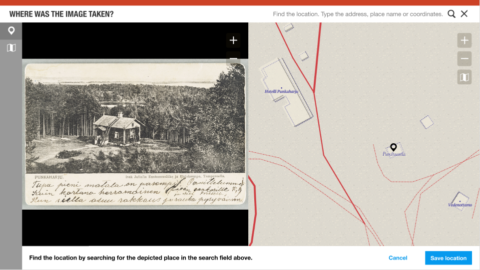
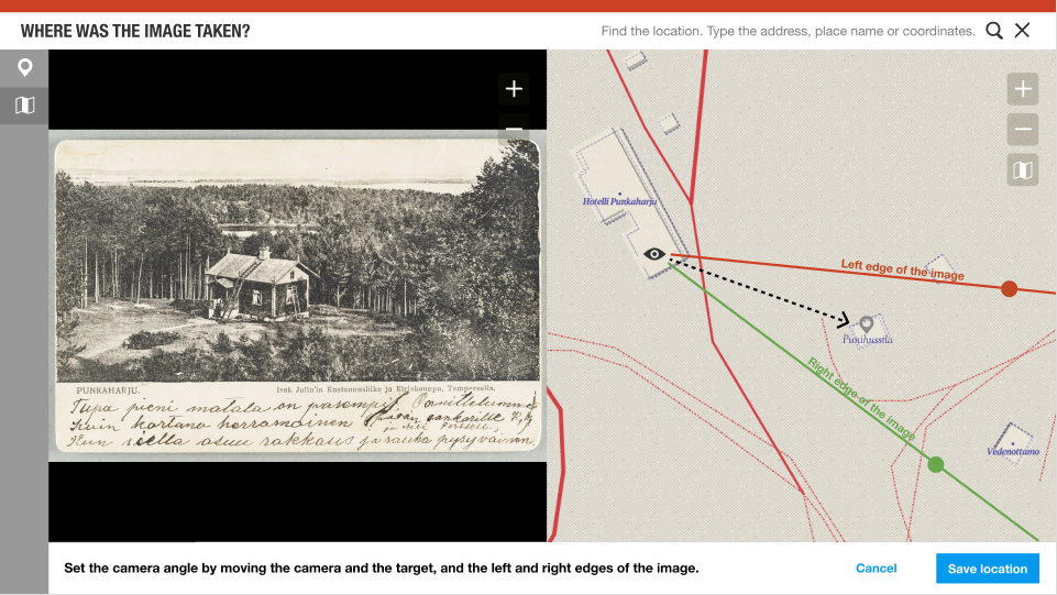
3. The geotagging interface is based on the Wikidocumentaries tools layout. It includes a split view of the zoomable image and the zoomable map.
Step 1
- The first step is to choose an existing location with the generic search pulldown (data from Wikidata and Wikidocumentaries).
- If the item does not have coordinates, the user is asked to add them (moving the POI to the right location).
- When the user confirms the location, it could make a search around that location and propose those items as the target.
- If the item does not exist, it would be possible to add it, but this might get too complex.
- If the item does not have coordinates, the user is asked to add them (moving the POI to the right location).
Enhancement ideas:
- The map could seek to a suggested location by parsing the data in the name and description, or existing location information.
| Wikidocs Vue variables | Wikidocs Wikibase property |
|---|---|
| depicts (P180) |
Step 2
- The user will place the camera, the target and the camera angle on the map.
- The user can skip this and save only the point.
Enhancement ideas:
- The user could point items in the map and equivalent items in the image. The field of view could be adjusted automatically based on that. (There will be an illustration of this).
- The user could frame the side of a building (or other object: street, pond, statue...) in the image and locate the equivalent in the image.
Controls
- It should be possible to use different background imagery: Aerial images, OSM, local official open map sources, historical maps. Maybe even display nearby images? This interface should be similar to the map interface in the topic page.
- Address or geographic search may be used to help find the location.
4. The geotagging data is added to the local image metadata.
- We can contribute to a standardised exchange format for geotagged photos.
5. The user contributions will accumulate, and methods of verifying best locations may be developed.
6. The original image, the image metadata and the added geolocation will be imported to Wikimedia Commons either manually immediately or as a scheduled bot task later. The original memory institution will be able to read the enhanced data from Wikimedia Commons.
Inspiration
Ajapaik web app
| About | Technology | Design | Content modules | Tool pages | Projects |
| Status
Wikidocumentaries Slack |
Setting up dev environment |
Components |
Active modules Module ideas |
Visual editor | Central Park Archives |
